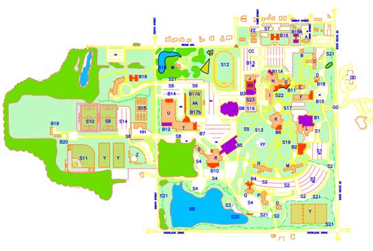


Topographic Mapping
GIS mapping makes it possible to combine all possible layers of digitized information and then manipulate and analyze them to relate them to each other.
Topographic mapping enables users to view the arrangement of various changes on land created by land cover, railway tracks and road ways. Topography maps are widely used as they showcase resources like roads, transmission lines, country borders, major buildings etc. Topography mapping techniques are used to enter all “physical” natural and man-made objects into a single database in order to gain insights.
Topographic mapping supports the following activities:
• Disaster management
• Engineering and architecture purposes
• Defense and Security
• Infrastructural services
• Route planning
• Geographical representation of thematic data
• Telecom and transport services
• Engineering and architecture purposes
• Defense and Security
• Infrastructural services
• Route planning
• Geographical representation of thematic data
• Telecom and transport services